2004 Survey
The main goals of this visit was to assess the site, narrow down the search area to an area less than 100 x 100 meters, and to speculate on the best geophysical approach.
Firstly, using the historical photographs and triangulation, we narrowed the search pattern.
Secondly, below the pictures of the site, we used GPS to map out the target search area. We also took reference points to aid in relocating the proposed survey site.
Using the historical photographs and triangulation to narrow the search pattern
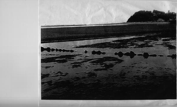
Figure 1: The first historic photograph showing the ribs of the ship protruding from the sand. Note the distant landmarks.
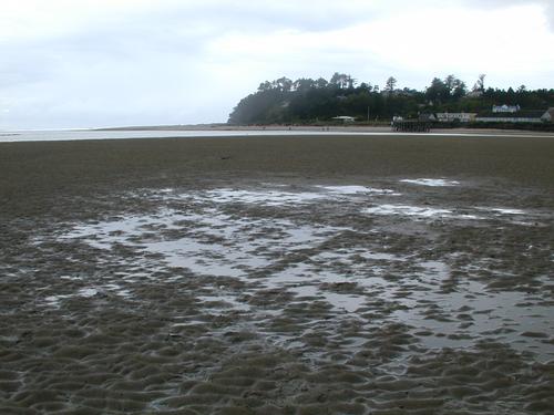
Figure 52: A modern view taken close to the same line of sight as the historical photograph. The photo was taken atop the line of site looking more Westerly.
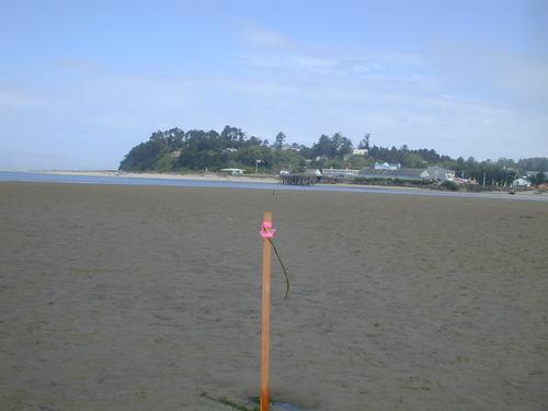
Figure 2: A modern view taken at the time of the 2005 survey.
The line of sight formed by the stake and the distant point of land is the line of sight indicated on the map, below.
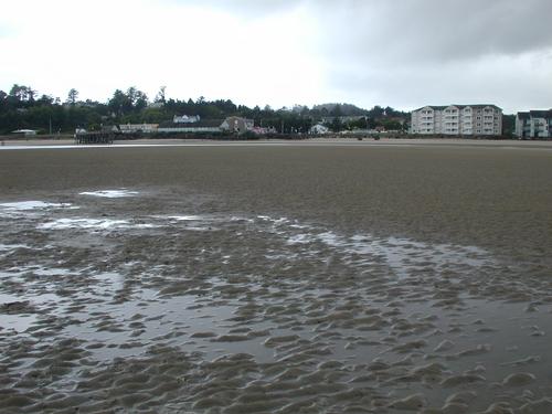
Figure 51: Atop the line of sight, looking down it; its is in line with the first historic photograph
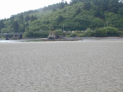
Figure 33: Atop the line of site looking in the direction of the second historic photograph (but a little too far North)
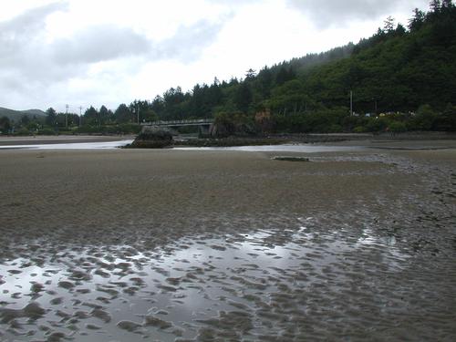
Figure 48: Atop the line of site looking in the direction of the second historic photograph (but a little too far South)
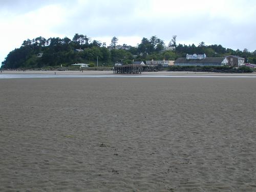
Figure 39: Atop the line of sight, looking to the west of it
Mapping a Portion of the Bay using GPS
Once a rough idea of the narrowed search area was established, a
partial map of the area about the survey area was created using GPS siteings.
The annotated map below shows this map.
In addition, a number of reference points were taken so that the survery area
could be located in subsequent visits.
The coordinates of these reference points are shown in the table below.
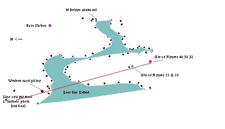
GPS data map
GPS DATA
See pictures and the notes, above.
| Point
| Northing (ft) | Easting (ft)
| Elevation (ft) | Description
|
| 4000 |
0.000 |
0.000 |
-93.896 |
Base station |
| 4526 |
-614.800 |
-836.814 |
-96.189 |
Location of
pictures 33 and 39
|
| 4527 |
-750.847 |
-743.722 |
-95.879 |
Location of
pictures 48, 51 and 52 |
| 4579 |
66.184 |
-1344.866 |
82.578 |
Top of most
westerly piling on warf
|
| 4548 |
-342.418 |
134.326 |
-69.203 |
North bridge
abutment, outside of rail |
| 4551 |
-347.047 |
99.505 |
-97.225 |
~40 feet west of bridge abutment |
A complete listing of the points is given
here
.