Archaeological Applications of Near-Field Remote Sensing
Bradley Matson Professor of Physics
Goal: To develop and utilize novel non-intrusive imaging techniques for
tell sites.
Team: Dr. Bradley Matson (Photon Kinetics), Dr. Jon Cole (Ameritus, Walla
Walla College), Dr. Gerry Sandness (Ameritus, Battelle -- Pacific Northwest Laboratories).
Location: The Madaba Plains, Jordan.
Abstract
Wouldn't it be nice if we could do non-destructive archaeology? Certainly, you need to get dirt under your fingernails,
excavate artifacts, and date strata. Yet, can you use non-destructive methods to get an overall picture of an archaeological
site? This presentation provides a tour of techniques which yield detailed, high-resolution (less than one meter) maps of
archaeological sites. These techniques yield maps of medium-sized areas (20 x 20 meters) in a matter of days or months,
provide the opportunity for three-dimensional maps, and generally give much better (resolution) maps than more traditional
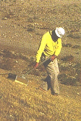
techniques. Key to these techniques is the analysis of the non-destructive data taken by either ground-penetrating radar or
acoustic pulse diffraction. This lecture reviews the application of near-field diffraction theory to these data taken from
tell sites on the Madaba Plains, Jordan and on Tel Rahov, Israel. This application produces two algorithms the results of which
are presented as examples of the approach.
Utilization: We have and continue to develop methods of imaging multiple-layer
tell sites with resolutions approaching 0.05 meters horizontally, 0.1 meters
vertically. We utilize near-field sensing techniques such as ground-penetrating
radar (GPR), acoustic diffraction, proton magnetometry, and electromagnetic
induction. Our fieldable computing capabilities allow for preliminary results
in the field.
Description: Many applications of remote sensing to archaeology are
performed in the far-field regime. That is, the 'viewing distance' -- the
distance between the detection system and the objects being imaged -- is
much larger than the characteristic distance between objects (i.e., features).
These include satellite imaging. We concentrate on near-field sensing where
the characteristic distance between objects is approximately the same as
the 'viewing distance'. Such applications include ground-penetrating radar
and time-dependent acoustic diffraction on tell sites. Since pulse widths
used by these sensing methods are on the order of the characteristic distance
between scatterers (unexcavated archaeological structures), this theory
must be applied in both the spacial and time domains. Application of the
theory to the typified features of a site yield distribution functions
which can be used to generate data reduction algorithms. Two such algorithms
are used as examples of this approach.
See 1994 Season Results
See 1996 Season Results
See 1998 Season Results
What are Inverse Filters? Learn more here from a class I'm designing.
How do I create these images? Learn more here from a class I'm designing.
A copy of the slides I used from my lastest talk.
Return to Professor Matson's Home Page
For more information email:
Dr. Matson